
Drone and GIS Services for Engineering Consultancies
What to Expect:
We provide fast, accurate drone surveying and advanced GIS analysis to support engineering and geotechnical projects. As licensed drone operators with strong engineering and geospatial expertise, we deliver reliable spatial data that integrates seamlessly into consultancy workflows.
Most projects are completed within three working days, allowing teams to move efficiently from site investigation to design and reporting.
Why Use Drone and GIS-Based Data:
Traditional site data collection can be slow, costly, and limited in coverage. Drone surveying combined with GIS analysis provides:
-
Drone surveying captures continuous, high density data across the full site rather than relying on isolated survey points. This provides a complete and consistent view of ground conditions, surface features, and terrain variability. Engineers gain greater confidence that critical features such as scarps, drainage paths, slope breaks, and fill areas are not missed during early assessment or design stages.
-
Remote data capture significantly reduces the need for personnel to access steep slopes, unstable ground, active slips, or flood-prone areas. Drone surveys allow sites to be assessed without exposing staff to unnecessary risk, while still delivering the detailed information required for geotechnical and civil design.
-
Drone data collection can be completed rapidly, and when combined with efficient processing workflows, deliverables are available within days rather than weeks. This allows engineering teams to review site conditions earlier, identify constraints sooner, and progress designs or investigations without delays.
-
Processed drone data is transformed into measurable products such as terrain models, contours, cross sections, slope maps, and spatial datasets. Outputs are checked for accuracy and provided in formats that integrate directly with engineering and geotechnical software, enabling reliable analysis and defensible reporting.
-
A single high quality dataset can support feasibility studies, detailed design, construction planning, and ongoing monitoring. Using consistent spatial data across project stages reduces duplication of work, improves coordination between disciplines, and ensures all teams are working from the same source of information.
This approach gives engineering teams a clearer understanding of site conditions early in the project lifecycle.
Simple and Efficient Workflow:
-
We confirm exactly what information is required, whether mapping, analysis, or engineering deliverables. This ensures the data collected is fit for purpose and avoids unnecessary rework.
-
We attend the site and carry out the drone survey in full compliance with aviation regulations. The flight captures high-accuracy imagery and terrain data, suitable for detailed engineering analysis with an accuracy of up to 2cm.
-
Upon returning to the office, the data is processed into usable spatial products. All outputs are checked for accuracy, alignment, and completeness before moving into analysis.
-
The processed data is then tailored to your project requirements using professional GIS software.
Engineering Focused Deliverables:
Depending on project needs, post-processing can include:
CSV files for cross sections suitable for slope stability and Slide analysis
Borehole location plans and supporting maps for geotechnical teams
Slope analysis identifying areas above specified gradient thresholds
Overland flow path and catchment delineation
Flood extent and surface water analysis
Site plans, contours, and terrain models.
Custom GIS outputs compatible with internal systems
All deliverables are provided in formats ready for immediate engineering use. Exportable in CAD.
Examples, Deliverables, and Downloads
Slope Calculation Map:
Catchment Calculations Map:
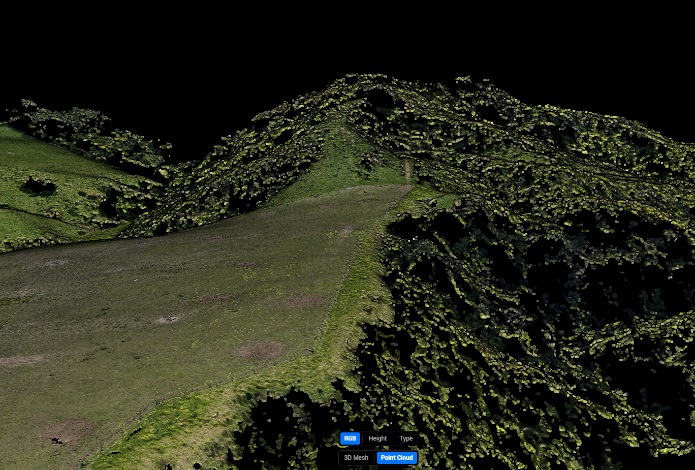
Point Clouds:
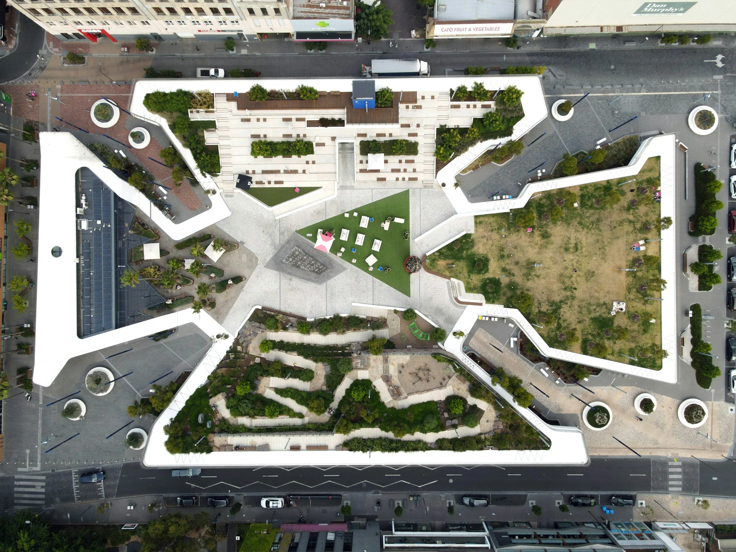
Site Plans:
Fast Turnaround Without Compromising Quality
Efficiency is central to our service. Through streamlined fieldwork and processing workflows, most projects are delivered within three working days. This allows consultancy teams to maintain momentum, meet tight deadlines, and reduce project risk.
Why Work With Us:
Licensed and experienced drone operators
Strong engineering and geospatial background
Focused on practical, engineer-ready outputs
Clear communication and efficient delivery
Flexible services tailored to each project
Our services are designed to support engineering consultancies by providing accurate data, fast turnaround, and analysis that directly informs design and decision-making.