
Drone and Mapping Services for Farmers
What to Expect:
We provide fast, practical drone and mapping services to help farmers better understand their land, improve productivity, and make informed decisions. Using licensed drone operations and advanced mapping software, we turn aerial data into clear, usable information for day-to-day farm management and long-term planning.
Most projects are completed within three working days, so you get results quickly when timing matters.
Why Use Drone Mapping on Your Farm:
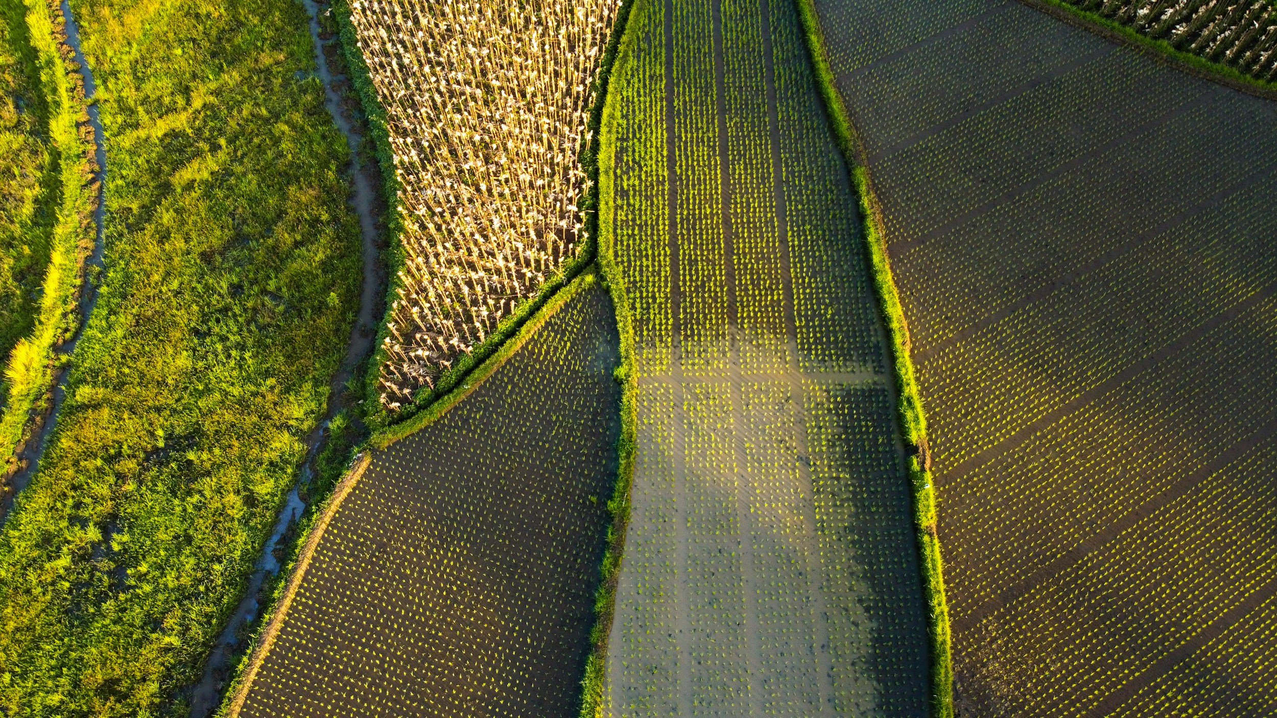
Walking large properties only shows part of the picture. Drone mapping provides a full overview of your land, helping you see patterns and issues that are hard to identify from the ground.
-
We map the shape of your land in detail, showing elevation, slope, and how the ground naturally falls. This helps identify usable areas, steep ground, and drainage patterns, supporting better decisions around grazing, development, and machinery access.
-
We analyse how water moves across your property to identify wet areas, low points, and natural flow paths. This information helps avoid problem areas, reduce pugging, and plan effective drainage improvements before issues arise.
-
Accurate mapping supports smarter placement of fences, tracks, yards, and buildings. By understanding slope and ground levels, infrastructure can be positioned in practical, accessible locations with good drainage and reduced long term maintenance.
-
By mapping slopes and catchments, we help identify erosion prone areas and runoff concentration zones. This supports targeted water management and erosion control measures that protect soil, improve land performance, and reduce future damage.
-
We provide clear maps and spatial data to support farm development and consent processes. Accurate site plans, contours, and drainage information help consultants and councils assess proposals efficiently and with confidence.
Accurate mapping reduces guesswork and helps you invest time and money where it matters most.
Simple and Efficient Workflow:
-
We start by understanding what you want to achieve, whether it is development planning, drainage improvements, or better land visibility.
-
We visit the farm and carry out the drone flight safely and legally. The drone captures high resolution imagery and terrain data across the areas that matter to you.
-
The data is processed back in the office into clear maps and models. Accuracy and completeness are checked before analysis begins.
-
The final outputs are tailored to your farm and how you operate it.
Farmer Focused Deliverables:
Depending on project needs, post-processing can include:
Detailed farm maps and site plans
Slope maps showing steep and workable areas
Drainage, overland flow paths, and catchment maps
Flood-prone and wet area identification
Contour maps for earthworks and land shaping
Mapping to support fencing, tracks, yards, and buildings
Custom maps to support consultants, contractors, or council applications
All outputs are easy to understand and provided in practical formats.
Examples, Deliverables, and Downloads
Basic Farm Map:
(150 Hectare Block)
Farm Layout:
(85 Hectare Block)
Slope Map:
Areas in red have a slope over 25 Degrees
Fast Results When You Need Them
We understand that farming decisions are time sensitive. With efficient workflows, most projects are completed within three working days, allowing you to act quickly and with confidence.
Why Work With Us:
Licensed and experienced drone operators
Strong understanding of rural land and terrain
Clear, practical maps that are easy to use
Fast turnaround times
Services tailored to each farm
Our goal is to give farmers clear visibility of their land, reduce uncertainty, and support smarter decisions for today and the future.